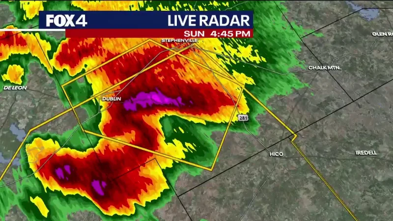
Gov. Greg Abbott activated Texas emergency resources on Sunday as severe storms with 75 mph winds, large hail and flash flooding threats moved across most of the state. The weather was expected to last through Monday morning, with tornadoes also possible.
The response covered West, North, East, Central and South-Central Texas, where forecasters warned wind gusts could top 75 mph and hail larger than 2 inches in diameter could fall. Some areas were expected to get up to 6 inches of rain, with isolated totals as high as 10 inches.
Abbott said Texas was prepared to confront the severe storms threatening communities across the state and urged people to remember, “Turn Around, Don’t Drown.” His office said the information came from the Governor Greg Abbott Press Office.


State officials deployed search-and-rescue teams and swiftwater boat squads to high-risk areas, along with Texas A&M Task Forces 1, 2 and 3. Helicopters with hoist capability from the Department of Public Safety and Texas Parks and Wildlife were also sent in, along with Tactical Marine Units, Texas Forest Service saw crews to clear debris from roads and Texas Department of Transportation personnel to monitor highway conditions.
Emergency medical task forces with ambulances and all-terrain vehicles were placed in the field, while monitors from the Public Utility Commission were assigned to coordinate power outage responses. State agencies were also watching the natural gas supply and water quality as the storm system moved through.
The threat was expected to include hurricane-force winds, giant hail and tornado risk before shifting toward the South and Southeast Texas coasts as the system progressed. For drivers, the immediate question is not whether the storm will be disruptive, but whether they are ready to check road conditions at DriveTexas.org, pack emergency kits and avoid flooded roads before the worst bands arrive.


