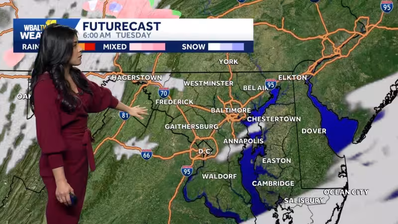
A Freeze Watch is in effect for Tuesday night and Wednesday morning as a widespread freeze is likely across most of Maryland by daybreak Wednesday. Temperatures are expected to fall into the mid and upper 20s outside the Baltimore Beltway, while the city should stay closer to 30 degrees.
That comes after cooler weather pushed back into the state behind Easter Sunday rain, and another shot of cold air is set to arrive tonight into Tuesday. By Tuesday morning, many neighborhoods are expected to drop back into the low to mid-40s by sunrise, then climb only into the low to mid-50s Tuesday afternoon with breezy winds.
The cold snap marks the chilliest point of the forecast, and the timing matters because it lands in the middle of the week when overnight temperatures are most likely to threaten early-season growth. Forecasters also mention a chance of sprinkles and spotty rain showers this evening before the colder air settles in fully.


Read Also: AEI Finds American Middle Class Now Largest Income Group
The freeze should not last long. Cool sunshine is expected to continue through Thursday before warmer weather builds back in. By the second weekend of April, temperatures are forecast to rebound into the mid-70s on Saturday and closer to 70 degrees on Sunday, a quick turn after the midweek chill.
Read Also: Trump News Conference Today Trump Sets Tuesday 8pm ET Deadline
For Maryland, the message is simple: the coldest night of this stretch is still ahead, and Wednesday morning is the one that looks most likely to bring a true freeze across much of the state.


