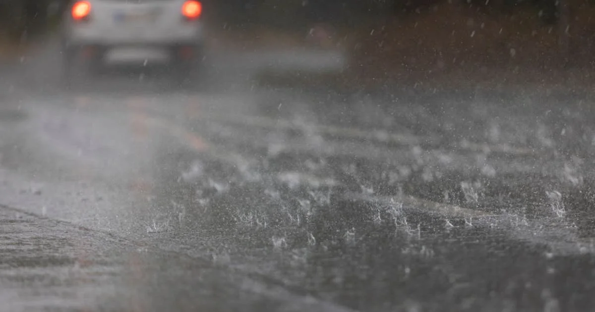
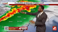
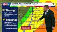
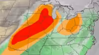
Detroit weather turns more unsettled tonight after a warm, mostly pleasant start to the workweek, with the best chance for storms arriving between 6 p.m. and midnight. The Storm Prediction Center has most of Metro Detroit in a level 1 marginal risk, while portions south of I-94 near the Ohio/Indiana border were upgraded this afternoon to a level 2 slight risk.
High winds and hail are the main concerns as temperatures climb into the mid to upper 70s this afternoon, giving way to a storm chance as the evening goes on. For a deeper look at the setup, see Click On Detroit Weather: Warm, dry break today before storms return tonight.
The warmer spell will not last long. Temperatures are expected to tumble back into the low 60s on Tuesday, and more showers with a possible rumble of thunder could return after 2 p.m. By the rest of the week, the pattern turns cooler than normal, with several days that may not even reach 60 degrees.
That cooler stretch also comes with a stubborn mix of unsettled weather, and a few shower chances are expected each day into the weekend. The one bright spot is that Monday’s storms should be short-lived; the broader forecast points to a damp, chilly week ahead rather than a prolonged severe-weather threat.


