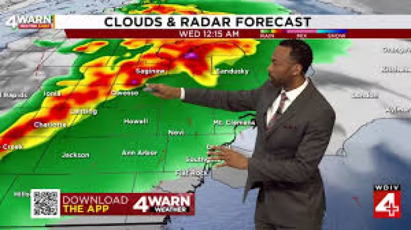
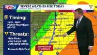
SE Michigan is bracing for a rough stretch of weather Tuesday night, with the Storm Prediction Center raising the storm risk to a level 3 Enhanced Risk and a Flood Watch set to begin at 8 p.m. and run through Thursday evening. The most severe storms are expected after 9 p.m. and could last until about 3 a.m., bringing high winds, hail, flooding and an isolated tornado risk.
The watch covers a period when heavy rain could keep falling into the morning commute, adding a second problem after the overnight storms pass. That is why the threat around Ann Arbor matters tonight: a tornado warning Ann Arbor may not be the only concern, and the region is facing a mix of wind, hail and water on roads at the same time.
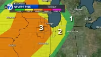
The risk is higher than the area has seen lately, with the Storm Prediction Center's upgrade putting Tuesday night at level 3 Enhanced Risk, above the level 2 Slight and level 1 Marginal categories that mark lower-end severe weather setups. While the strongest storms are timed for late evening and overnight, multiple chances for rain on Wednesday and Thursday keep the flooding concern alive long after the first round moves through.
That overlap is the problem. A fast-moving severe line can damage trees, power lines and roofs in the middle of the night, then leave behind saturated ground that cannot take much more water. With the Flood Watch lasting through Thursday, April 16 evening, the next question is not whether southeast Michigan gets rain, but how much of it falls before people can get a break.


