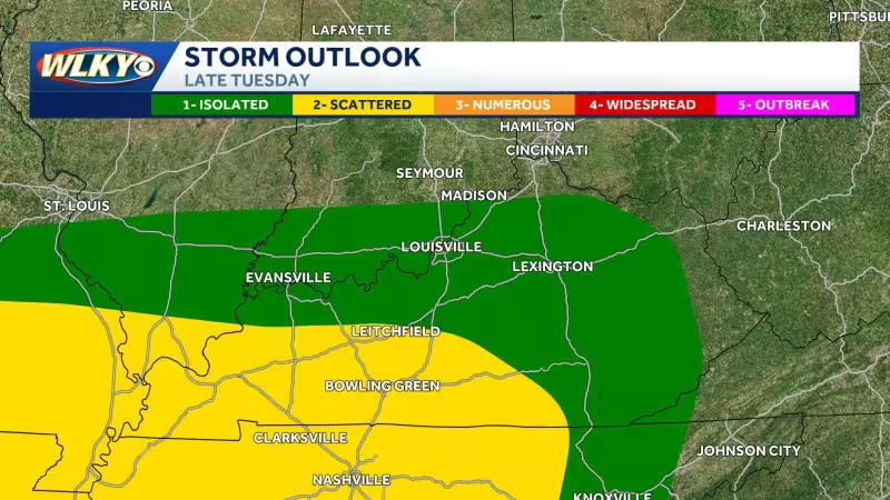
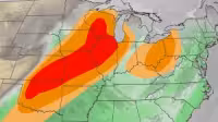
Rounds of showers and storms are expected over the next few days, and another low pressure system is set to swing through the region Tuesday night into Wednesday. The Storm Prediction Center has placed most of the WLKY viewing area, including the Metro, under a marginal risk for severe storms, while the far southern counties are in a slight risk.
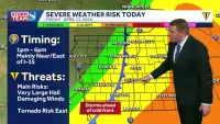
The main threat with the Tuesday night storms will be gusty winds and large hail, though a brief spin-up tornado cannot be ruled out. That makes the period from Tuesday night into Wednesday the one to watch as the next system moves in after the first wave clears.
The risk matters because it covers most of the WLKY viewing area, including the Metro, at a time when people are already looking ahead to a stretch of major Kentucky Derby Festival events and the weather can change fast. Behind the system, cooler and drier air will move into the Ohio Valley, leaving highs in the 50s and 60s for Thurby, Oaks and Derby.
That shift should bring a break from the unsettled pattern, but only after the midweek system passes through. For now, the better forecast is one of short-lived severe weather threats followed by a cooler setup for the days that matter most.


