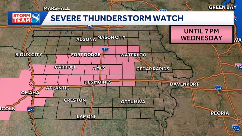
Much of central and southeastern Iowa was under a tornado watch until 9 p.m. Wednesday as storms moved across the state, with severe thunderstorm warnings also in place for several counties and more alerts possible later in the day.
The watch covered counties including Polk, Story, Jasper, Dallas, Warren, Johnson, Linn, Scott, Dubuque, Cedar and Des Moines, while a severe thunderstorm warning was issued until 4:30 p.m. for parts of Polk, Story and Jasper counties. Another warning was in effect until 1 p.m. for parts of Greene, Guthrie, Audubon, Sac, Calhoun, Crawford and Carroll counties, and several counties in western Iowa were under a separate warning until noon.
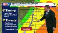
A thunderstorm reported about 23 miles southwest of Denison brought golf ball-sized hail and 60 mph wind gusts, a reminder that hail was the main concern for storms that fired north of Interstate 80 before 3 p.m. More storms were expected to develop in a scattered pattern across central Iowa after 3 p.m., with large hail and damaging wind gusts the most likely threats and only a low risk of tornadoes.
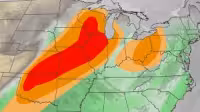
That left a large part of Iowa exposed to severe weather for much of the afternoon and evening, with the Storm Prediction Center also able to issue either a severe thunderstorm watch or possibly a tornado watch later Wednesday. For residents watching Kcci Radar and similar forecasts, the immediate concern was not one single storm but a shifting line of them, each capable of producing hail and strong wind before the day was over.


