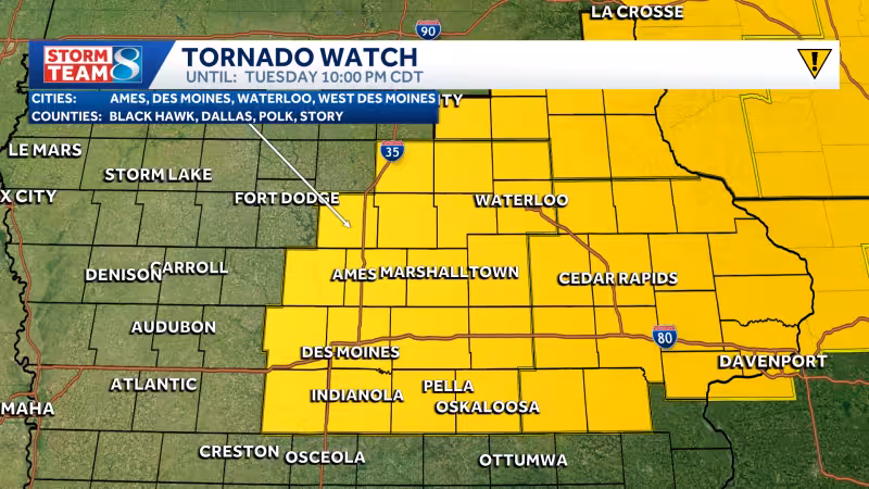
The National Weather Service issued a tornado watch for much of central and eastern Iowa until 10 p.m. Tuesday as a stalled front set the stage for storms across the state. Storms could form as early as 2 to 4 p.m. near and just east of I-35, then intensify as they move into eastern Iowa.
The watch covers Allamakee, Benton, Black Hawk, Boone, Bremer, Buchanan, Butler, Cedar, Chickasaw, Clayton, Clinton, Dallas, Delaware, Dubuque, Fayette, Floyd, Franklin, Grundy, Hamilton, Hardin, Howard, Iowa, Jackson, Jasper, Johnson, Jones, Keokuk, Linn, Madison, Mahaska, Marion, Marshall, Muscatine, Polk, Poweshiek, Scott, Story, Tama, Warren, Washington and Winneshiek counties. South of the front, highs will surge into the mid-80s with high humidity, a setup that could fuel very large hail, high winds and some tornado risk.
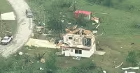
The greatest threat is expected near and south of the boundary, where storms may be able to draw on the day’s strongest instability. The very large hail risk could reach around 3 inches in size, and forecasters say an intense tornado is possible if storms use all the ingredients available. That risk is why the watch remains in place through the evening rather than waiting for a storm to already be on the ground.
Iowa has multiple chances for severe weather built into the rest of the day and into Wednesday. A second area to watch is southern Iowa later tonight, where increasing southerly flow may help develop another wave of storms spreading from south to north. Those overnight storms carry a lower severe risk, but they can still bring heavy rainfall and some small hail.
Wednesday does not offer much of a break. There is a low chance for a few storms in the morning, followed by another round of strong to severe storms by Wednesday afternoon and evening. The stalled front will still be draped across parts of the state, and it will again be the focus for storm development. For Iowa, the question is not whether the pattern turns active, but how much of it can organize into the kind of storms that bring damaging hail and tornadoes.


