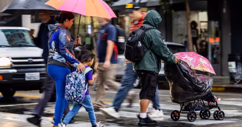
Heavier rain is expected to move across Los Angeles this weekend, with parts of the region likely seeing rain after 11 p.m. Saturday and scattered showers arriving Sunday afternoon before 2. The National Weather Service said Saturday that some neighborhoods also face a 15% to 25% chance of thunderstorms.
Those storms, if they form, could bring brief heavy rain, gusty outflow winds, small hail and even waterspouts or weak, short-lived tornadoes. The expected rainfall total through Sunday night is between 0.50 and 1.50 inches, with the average high in Los Angeles on Sunday near 65 degrees.
The storm arrives as a ridge of high pressure has already shifted east, opening the door for a system that could linger over parts of Los Angeles through Monday. The National Weather Service said people in Southern California should be ready to adjust plans and keep an eye on the forecast.
Read Also: Fresno Weather: Tornado warning issued near South Dos Palos as storm moves northeast

Todd Hall, a meteorologist, said the setup is the kind that makes the weather more active in spring, when differential heating becomes more pronounced. “This is when the weather gets a little more wild, technically, because we’re starting to see some more differential heating on the Earth,” he said. Hall added, “Just like in the ocean, we have waves. The atmosphere behaves the same way,” underscoring why showers and thunderstorms can develop so quickly.
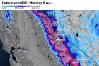
The wettest weather is expected farther north and west, where heavier rain and some thunderstorms are forecast for San Luis Obispo County, Santa Barbara County and Ventura County. Wind gusts north of Point Conception in Santa Barbara County could be strong enough to bring down trees or powerlines, while the northern Ventura County mountains could even see wet snow as snow levels drop at higher elevations.
Read Also: Tornado Warning In California Issued for Parts of Central Valley
Parts of the Mojave Desert are also expected to see gusty winds, but major flooding and debris flows are unlikely. The wider pattern should turn dry and warm again after Monday, with temperatures climbing to more than 75 degrees later in the week and reaching nearly 80 degrees next Saturday.
For now, the message from forecasters is simple: the rain is coming, the timing is uneven, and the weekend plans may need to move with it. The question is not whether Los Angeles will feel the storm, but how many places will get hit before the system moves on.


