A wintry storm system moving in from Alaska is expected to reach western Washington within 24 hours, turning Monday’s showers into a mess of rain, wind and heavy mountain snow by midweek.
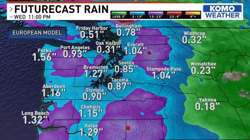
Light, patchy rain and drizzle are expected today and tonight, then rain is expected to spread into Forks and Port Angeles Tuesday morning and build around Seattle, especially north along Interstate 5. Gusty southwest winds should pick up Tuesday midday and afternoon, while the Olympic Mountains and the Cascades above 3,000 feet take on heavy snow. By Wednesday morning, snow levels are expected to drop below 1,000 feet, with some peaks blanketed by 20+ inches of snow and slick passes likely at Stevens and White. Snoqualmie may get snow-covered by Wednesday morning as the winter storm warning replaces an earlier winter storm watch.
The storm’s timing matters because the worst conditions are expected to hit during the middle of the week, when roads and mountain travel can change fast. Rain is expected to break up Tuesday night, and heavy mountain snow is expected to die down into the evening on Wednesday, leaving the rest of the week dry with sun and chilly mornings. Colder air and frost are expected to settle in for Thursday morning after the storm passes.
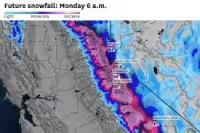


The forecast carries a tension that will matter to travelers: lower elevations are not being spared, even as the deepest snow is aimed at the passes and higher terrain. The warning specifically flags Stevens, White and Snoqualmie passes, where snow-covered roads could arrive quickly if the colder air drops snow levels as expected.
That makes the next 24 to 48 hours the critical window. Rain and drizzle come first, but the national weather service forecast points to a swift shift to winter by Wednesday, with the sharpest impacts on mountain travel before conditions calm down late in the day.


