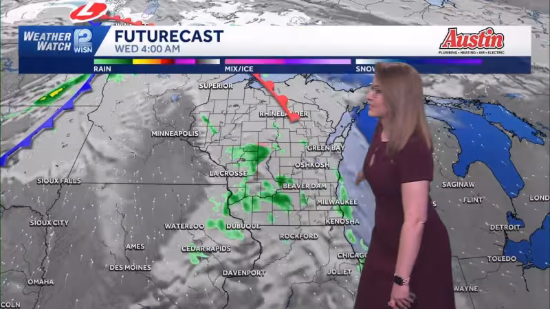
Early rain showers are expected to reach the Milwaukee area Wednesday morning, and parts of the region may even see a wintry mix as temperatures start near freezing. The showers should move out later in the morning, and skies are expected to gradually clear through the afternoon as highs warm into the low to middle 60s.
That quick turnaround will not last long. Rain with a few thunderstorms is expected to return late Wednesday evening and night, then move out by early Thursday morning. Thursday should be a bit cooler but still mild, with a mix of sun and clouds, before another chance for rain arrives late Thursday evening and showers linger into early Friday.


Friday is expected to stay dry for most of the day with highs in the low 50s, and Saturday should be drier with seasonable temperatures in the low 50s. The milwaukee weather pattern turns more active again Sunday and Monday, when storm chances are expected as temperatures jump into the low 70s, before rain chances continue Tuesday and afternoon highs fall back into the low 50s.
Read Also: Potawatomi Casino Hotel fire burns in Milwaukee after boiler issue
It is a week of sharp swings for southeast Wisconsin, with temperatures expected to rise from near freezing Wednesday morning to the low 70s by Sunday and Monday, then drop again Tuesday. For anyone planning around the milwaukee weather, the main takeaway is simple: the middle of the week brings brief improvement, but the wetter pattern returns before the weekend is over.


