
Friday will bring variable cloud cover, spotty showers and thunderstorms, and a First Alert Weather Day late in the afternoon and evening because one or two storms could become strong or even severe. The day starts warm, with a low of 62 and a high of 84, before the rain chance rises to 50% in the afternoon.
In the morning, a weakening batch of showers and storms will move into western communities from the northwest while conditions stay variably cloudy and warm. By afternoon, the forecast turns variably cloudy and very warm, with spotty showers and thunderstorms expected and brief downpours possible later in the day.
Damaging wind is the main severe-weather concern for Friday. That risk is not broad, but it is enough to make the late-afternoon and evening period stand out, especially for people with outdoor plans or travel across the Knoxville area.


Monday is also a First Alert Weather Day, and it brings a different kind of threat. An organized batch of strong to severe storms is expected Monday evening, with the potential for damaging wind, isolated tornadoes, heavy downpours and some hail. The storm threat is expected to move into the area around sunset from the northwest, making late Monday and Monday night the period with the greater potential for severe thunderstorms in Middle Tennessee.
After that, the forecast quiets down somewhat, but not completely. Wednesday carries a 30% chance of showers and storms, which means more unsettled weather remains in the mix even after the stronger storm threat passes.
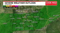
For now, Friday is the day that asks for the most attention in Knoxville weather, with the main severe concern centered on a few stronger storms late in the day and another round of more organized severe weather waiting for Monday evening.


