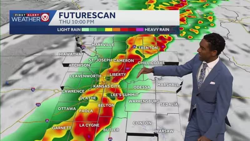
A front is expected to move through the Kansas City metro region this evening, bringing warm, humid air into a weather alert day and setting up strong storms that could turn severe. Damaging winds are the most likely threat, but large hail and a quick spin-up tornado cannot be ruled out.
The rain and storms are expected to exit overnight, giving the metro quieter conditions Friday and Saturday before another risk of stronger storms returns late Sunday into Monday. For Kansas City, the day is about staying alert through the evening window, because the most dangerous weather is expected to arrive before the front clears and then move out while people are still awake to see it.


The threat is regional and tied to the approaching front, which is why the same stretch of unsettled weather can bring different hazards in a short span of time. Damaging wind remains the main concern, but the possibility of hail and a brief tornado means the strongest storms could change fast as they cross the area.
That makes the next several hours the critical period, not the whole weekend. Once the storms leave overnight, Friday and Saturday are expected to be calmer, but the break may not last long: another round of stronger storms is expected late Sunday into Monday.


