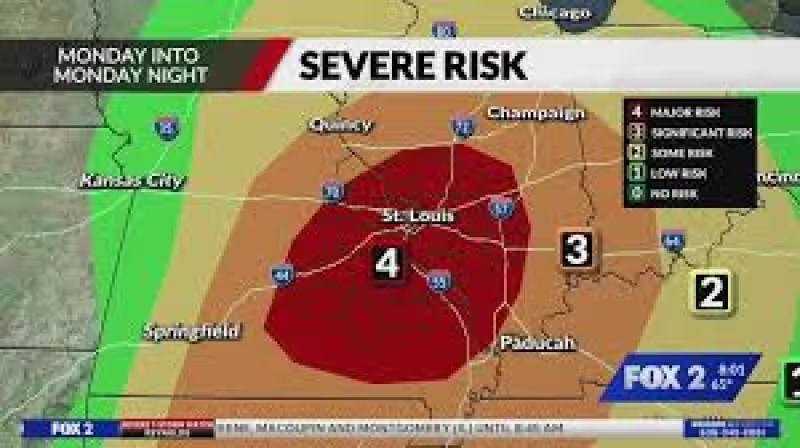
Strong tornadoes, including some that could reach EF3 strength, are possible today across eastern Missouri, southern Illinois, southwestern Indiana and far western Kentucky as another day of severe weather stretches from the far northeastern portion of Texas to southern Michigan.
The most serious threat is centered in the mid-Mississippi River Valley, where strong tornadoes, very large hail and gusty winds are expected. Cities including St. Louis and Chicago need to stay weather-aware as the line of storms advances.


The Weather Channel says the setup is part of a broader regional pattern, and that larger footprint explains why the danger is not confined to one state or one storm system. The risk runs through a broad swath of the country, but the corridor from eastern Missouri into southern Illinois, southwestern Indiana and far western Kentucky is the place where the threat is sharpest today.
That leaves little room for doubt about what matters most right now: the storm zone is wide, but the tornado risk is focused, and it includes the kind of severe-weather ingredients that can turn quickly. For people in the path, the question is not whether this is another active day. It is whether they are ready when the warning comes.


