Kansas is moving through a sharp weather swing that starts with critical to extreme fire danger west of I-135 today and shifts toward storms by Tuesday. Fire Weather Warnings are in effect now, while Fire Weather Alerts are also posted for Tuesday as gusty winds and very dry air keep the risk elevated across part of the state.
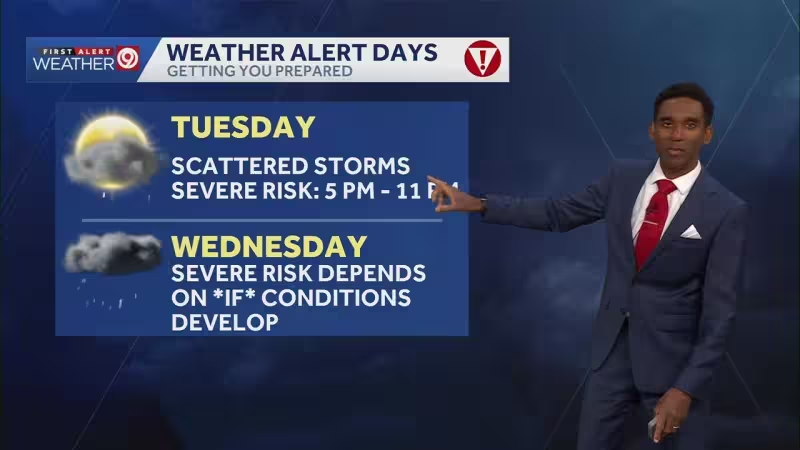
A few storms have already bubbled up over southcentral Kansas this evening and are tracking northeast, but the larger story is what comes next. The warmth has built, yet it has not been enough to shut down the atmosphere, and isolated strong to severe thunderstorms are still possible tonight before the more organized threat arrives Tuesday afternoon into evening.
The setup is defined by a dryline stretching across Kansas, with much higher humidity to the east and bone-dry conditions to the west. That boundary, paired with gusty winds that should continue through tomorrow, is helping keep fire danger at elevated to critical levels again on Tuesday even as the chances for showers and storms improve from central into eastern Kansas, with the heaviest focus over and east of the Turnpike.
Severe weather risks are outlined for Tuesday for all forms of severe weather, and a tornado is not off the table. The higher chance for that threat appears to be over central Oklahoma, with the risk extending right up to the Kansas state line. Development is expected to begin in the afternoon and ramp up in the evening, and while there may not be a ton of storms, forecasters say a few of them could be powerful.
Another severe-weather risk is positioned near and east of the Turnpike on Wednesday, before a brief break from storms on Thursday. Friday looks active again, with more storms expected from central into eastern Kansas. Then the pattern turns much colder over the weekend, when a few snowflakes may reach the northwest and temperatures there are expected to dip below freezing.
Central and eastern counties are expected to stay warm enough to avoid frost, but only barely. Highs will fall from 87 and 61 today to 80 and 52 on Tuesday, then 84 and 42 on Wednesday, 62 and 38 on Thursday, 68 and 47 on Friday, and 73 and 52 by the time temperatures swing warmer early next week. For Kansas, the next few days bring a little of everything: fire, storms and then a fast return to cold.


