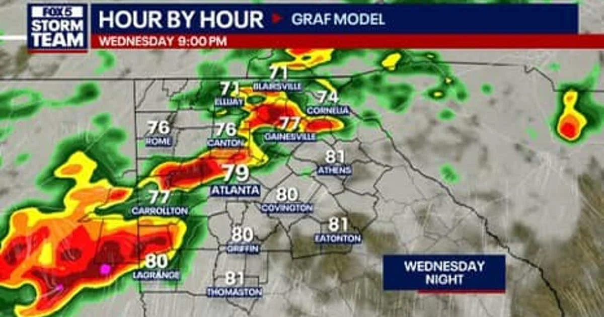
Metro Atlanta was upgraded Wednesday to a Level 2 severe weather risk as an approaching storm system moved toward north Georgia, with the main line of storms expected to reach the region around 8 p.m. The threat was expected to taper off overnight, but scattered showers and storms could linger into Thursday morning before the weather dries out later in the day.
The upgraded zone stretched from Calhoun to Dawsonville and Gainesville and south through Eatonton, Griffin and LaGrange, with the tornado threat nudged slightly higher across parts of northwest Georgia. The stronger storms were expected to focus more in Mississippi and Alabama than in northwest Georgia, but Georgia was still expected to feel the system’s impact, including heavy rainfall totals of 2 to 3 inches in some areas.


That much rain would be a problem because the ground is dry, making it easier for water to pool and flooding to develop quickly if the rain falls fast. One forecaster warned, “Don’t sleep on this,” and said, “These can still be very strong storms even if they only affect a few areas Wednesday.” Another said, “If this model holds true, the main severe weather threat would be late in the evening,” adding that the “severe storm threat would taper off overnight, but the rain not necessarily.”
The stretch of unsettled weather comes after highs near 80 degrees on Tuesday and Wednesday and morning lows in the 60s on Wednesday, a mild setup that has done little to break the pattern. Rain chances were expected to return this weekend and into early next week, which one forecaster said is welcome after a dry spell, noting, “In the days to come, it’s an unsettled pattern — but that’s exactly what we need,” and “We don’t need a lot of rain at once, even though we might see that tomorrow.”
For now, the key question is not whether rain is coming. It is how fast it falls. With dry ground in place and a storm line arriving late Wednesday, the risk is less about a long soaking than a quick burst that can overwhelm streets and low spots, the same kind of danger that has prompted concerns in other heavy-rain events such as Flooding Road Closures Possible as Storms Threaten San Antonio Friday and Flash Flood Warning Texas: San Antonio watches heavy rain through Friday evening. If the forecast holds, the storm will bring needed moisture without the kind of widespread flooding that can turn a routine rain event into a problem overnight.


