Dangerous severe weather is expected to spread across the Central U.S. early Friday afternoon, with supercell thunderstorms capable of producing strong EF-3 tornadoes, monster hail and damaging winds setting up along a broad swath of the Midwest and Plains. More than 50 million people are in the path of storms expected to turn violent as the day goes on.
Supercells could form Friday afternoon across parts of Wisconsin, Minnesota and northeast Iowa, while similar storms are also possible from Kansas City into northern Oklahoma through the afternoon hours. The storms could produce hailstones greater than 3 inches in diameter, and by Friday evening damaging wind gusts of 75 mph or greater are expected to become the main hazard across the Plains and the Midwest.
NOAA's Storm Prediction Center has placed a 700-mile corridor under a Level 3 out of 5 risk of severe thunderstorms, stretching from just north of Oklahoma City through Kansas City, Missouri, and into La Crosse, Wisconsin. The Chicago metro area is also within the threat for the most intense storms, putting one of the nation’s busiest regions in the path of the developing system.
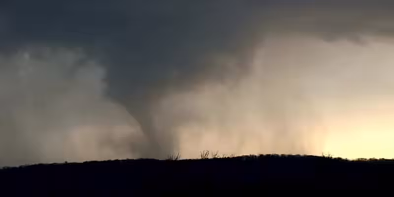
The new round comes after much of the Central U.S. was already hammered by severe weather earlier in the week. Destructive flooding hit Wisconsin, Texas and Kansas, and several damaging tornadoes were reported across the Midwest. FOX Weather Storm Tracker Corey Gerken captured footage of a tornado near Amboy, Minnesota on Monday afternoon, while golf ball-sized hail fell across Faribault, Minnesota, and ping pong ball-sized hail blasted Middleton, Wisconsin on Tuesday. Severe weather also left trees down in Colgate, Wisconsin, snapped trees and power poles in Ann Arbor, Michigan, and pelted cars in Marion, Indiana.
The pattern is not easing; it is shifting. After a week of flooding, hail and tornadoes, Friday’s threat broadens the damage zone and raises the stakes for millions who may face strong tornadoes first, then giant hail, then wind gusts strong enough to do major damage by evening. For people in the corridor, the next few hours are not about whether the weather will turn severe, but which danger arrives first.


